New Delhi ROADS MAP

Click to enlarge
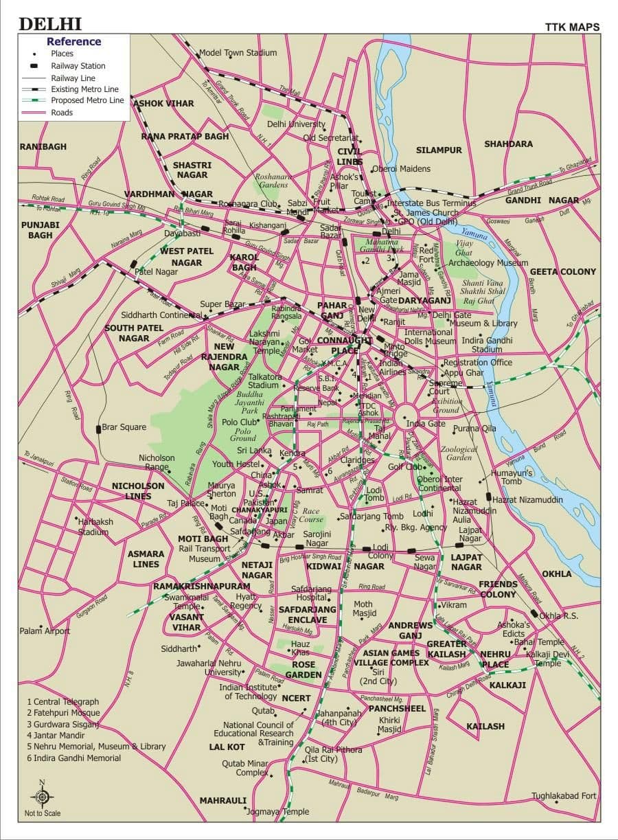
The New Delhi roads map shows all road network and highways of New Delhi. This roads map of New Delhi will allow you to find your routes through the roads and motorways of New Delhi in India. The New Delhi roads map is downloadable in PDF, printable and free.
Transportation dependent upon roads. Railways, including rapid transit systems like New Delhi Metro. Roads in Delhi are maintained by Municipal Corporation of Delhi (MCD), New Delhi Municipal Council (NDMC), Delhi Cantonment Board (DCB), Public Works Department (PWD) and Delhi Development Authority (DDA). At 1749 km of road length per 100 km², Delhi has one of the highest road densities in India. Major roadways include the Ring Road and the Outer Ring Road, which had a traffic density of 110,000 vehicles per day in 2001 as its shown in New Delhi roads map. Total road length of Delhi was 28,508 km including 388 km of National Highways. Major road-based public transport facilities in Delhi are provided by DTC buses, auto-rickshaws, taxis and cycle-rickshaws.
Inner Ring Road is one of the most important “state highways” in New Delhi. It is a 51 km long circular road, which connects important areas in Delhi. Owing to more than 2 dozen grade-separators/flyovers, the road is almost signal-free. The road is generally 8-laned with a few bottlenecks at certain stretches, which are being removed. The road has already achieved its carrying capacity of 110000 vehicles per day and would require an addition of more lanes to fulfill needs of increasing traffic by 2011. Outer Ring Road as you can see in New Delhi roads map is another major artery in Delhi. The road which was almost neglected till early 2000s is now an important highway that links far-flung areas of Delhi. The road is 6-8 lane and has grade-separators and a large number are under construction as a part of project to make the artery signal free. The road along with the ring road forms a ring which intersects all the National Highways passing through Delhi.
New Delhi is connected by NH 1,2,8 and 24 as its mentioned in New Delhi roads map. It also has 3 expressways (6 and 8 lane) that connect it with its suburbs. 4 more expressways are also planned and are supposed to be finished by 2010. Delhi-Gurgaon Expressway connects Delhi with one of its financial hubs, Gurgaon. DND Flyway connects Delhi with its other financial hub, Noida. Noida-Greater Noida Highway connects Noida with Greater Noida, which is an upcoming financial and commercial hub and is also to have a new international airport. The construction work for 135.6-km long Delhi Western Peripheral Expressway also known as the Kundli-Manesar-Palwal Expressway(KMP) is going on at full swing. Kundli-Manesar-Palwal (KMP) expressway expected to become operational by June 2009, Delhi will be relieved of the congestion of heavy night traffic. It will act as a bypass for the night vehicles.