New Delhi topographic map
You can find on this page the New Delhi topographic map to print and to download in PDF. The New Delhi elevation map present the topography, river and relief of New Delhi in India.
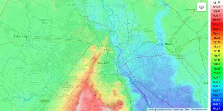
New Delhi elevation map
The New Delhi topographic map shows elevation, hills and landforms in New Delhi. This elevation map of New Delhi will allow you to know topography, river and relief of New Delhi in India. The New Delhi topographic map is downloadable in PDF, printable and free.
With a total area of 42.7 km2, New Delhi forms a small part of the Delhi metropolitan area and is located in the Indo-Gangetic Plain because of which there is little difference in the city altitude as its mentioned in New Delhi elevation map. New Delhi and surrounding areas were once a part of the Aravalli Range, but all that is left now is the Delhi ridge, which is also called the Lungs of Delhi. The second feature is the Yamuna floodplains; New Delhi lies west of the Yamuna river, although for the most part, New Delhi is a landlocked city. East of the river is the urban area of Shahdara. New Delhi falls under the seismic zone-IV, making it vulnerable to earthquakes.